Tuesday, July 31, 2018

Day 24 - Ludington to Midland MI

Ride Stats:
Distance: 133.7 Miles
Climbing: 3,294 ft
Ride Time:  8:09
Temp:  54-79


We had relatively good conditions for today's ride.  Started out cool and stayed moderate all day.  We had some lite headwinds, but nothing that we could not easily handle with our group.  Our group as a whole was stronger today following yesterday's break.

Our trip through western Michigan was very scenic - heavily wooded with rolling hills including parts of the Manistee forest.

The road conditions started out great, then turned bad (poor condition) after our lunch stop.  We then hit the Pere Marquette bike trail to Midland, which provide a welcome improvement.

We are nearing the end of our transcontinental tour - only 8 more riding days remain until we reach Rye's Beach New Hampshire.

Pictures from today:
At our first SAG stop 31 miles outside of Ludington

Day 23 - Manitowoc WI to Ludington MI

Today was a well earned rest day.  Typically our morning rides start sometime around 6:30 to 7:00.  We slept in today, having until 11:00a.m. to check out of the hotel and load our gear bags.  We then took a very old coal burning ferry (the Badger) across Lake Michigan to Ludington.  We all found places to relax onboard for the 4 hour trip, then traveled two miles to our hotel after arrival.

Pictures from today:
The Badger

Arriving in Ludington with a Coast Guard escort

Backed into this dock

Catching some ZZZ's on deck

Monday, July 30, 2018

Day 22 - Portage to Manitowoc, WI

Ride Stats:
Distance: 127.9Miles
Climbing: 4,757ft
Ride Time:  8:04
Temp:  56-82

We arrived at Lake Michigan and are primed for our one and only rest day as we cross the lake on Monday.

Today's route took us through relatively flat farm areas including some Amish sections.  At one point there were a number of horse and buggy's on the road, and one family walking, all headed to the local Amish church.   As we headed east, the hills increased substantially in size.  We ended up doing much more climbing than we expected and had a number of climbs in the 10% to 13% range. Temperatures continued to be moderate with lite tail winds - a continuation of ideal riding conditions.

I have not been taking very many pictures over the last few days.  The mount for my bicycle camera (Garmin Virb) has not been holding well, so I took it off until I can find time to fix it.  Also, when the sites look mostly like home I typically don't take pictures.  The PAC Tour website (pactour.com) has great pictures each day, so you can check out their web site if you would like to see more.

Pictures from today:
Looking out to Lake Michigan two blocks from our hotel.  Maritime Museum is on the left


Saturday, July 28, 2018

Day 21 - La Crosse to Portage, WI

Ride Stats:
Distance: 142.0 Miles
Climbing: 3,048ft
Ride Time:  8:35
Temp:  59-80

We are on a roll - great riding conditions once again today.  We rode through the wooded hills of western Wisconsin, seeing a number of dairy farms including an Amish area.  As we approach central Wisconsin, the rolling hills gave way to more flatland with farms.

Our route took us on mostly county roads with a fair amount of zig zagging to get to where we needed to go.  We encountered three unexpected construction zones in which the roads had been removed and we had to walk or ride our way through.  The last one was quit extensive.  We tried to ride through but myself and one other crashed after hitting some sand that looked like hard packed soil.  I ended up walking my bike or shuffling along with one foot clipped in and the other free to push along the ground.

All of us are looking forward to Monday - our first and only rest day while we cross Lake Michigan.  This is such an intensive ride, all the riders have some form of physical issues.  The one rest day will be very helpful.

Pictures from today:
The bridge over the Mississippi, from our hotel parking lot was getting ready to start today

Coullee Overlook with morning fog


Friday, July 27, 2018

Day 20 - Albert Lea MN to La Crosse WI

Ride Stats:
Distance: 142.0 Miles
Climbing: 3,048ft
Ride Time:  8:35
Temp:  54-77

Today's ride was long, but easier than most days.  We had another day of tailwinds.  Hope this continues as a trend.

We started with continuing our charge through the flat farm lands, then hit hills and trees as we took close to 52 miles of bike trails through the final eastern stretch in Minnesota.  The bike trail was lot's of fun.  We were in a tree canopy for a large portion and followed a meandering river.  This was a welcome change from the flatlands.  We then crossed the Mississippi river into La Crosse, Wisconsin.

We had a moment of excitement on the bicycle trail when we encountered a live snake in the middle of the trail and the group had to swerve on either side to miss it.  It was a dark snake with light colored bands and a diamond shaped head.  Most likely poisonous.  Some thought it might have been a cotton mouth.  Fortunately, we scared the snake just as much as it scared us.

The group I ride in is known as the slow group because we are the last to arrive at the hotel each day.  Lon & Susan have assured us that we are doing well, but this years group is much stronger than in prior years.  We could pick up the pace a little quicker and spend less time at the SAG stops, but we are having too much fun together with our approach to the ride.  We typically have several riders from other groups join us periodically when they need some rest from their hard charging or just want to have more fun.

All of us are looking forward to Monday, our first and only rest day.  We will be taking a ferry across Lake Michigan.

Pictures from today:

Bridge over the Mississippi

House boats on the Mississippi

More progress

Thursday, July 26, 2018

Day 19 - Worthington to Albert Lea MN

Ride Stats:
Distance: 119.9 Miles
Climbing: 2,038ft
Ride Time:  6:39
Temp:  61-77-68

We had a great ride today, rolling through the flatlands with a nice tailwind and cool temperatures.  The only complaint was an extended section of the route with bone jarring expansion joints leading up to just before the lunch stop.  With sore butts and aching joints from all the day after day riding miles, this was a torture test.  But with strong tailwinds and smooth roads after that section, we soon forgot and enjoyed kicking the pace line into high gear.  Given the inherent competitive nature of cyclists, somehow the ride after lunch turned into a hammer fest with each rider trying to outdo the others during the segment leading to our next SAG stop.  Some bantering back and forth seemed to be the spark that lit the fire.

There was a cold front pushing through, with the temperature dropping from a high of 77 down to 68 by the time we were nearing Albert Lea.  There were a number of dark clouds blowing by, but we only received a few drops of rain.

I was very much relieved that my early stages of  Achilles Tendonitis seemed to moderate today.  After Ibuprofen, ice packs, and taping prior to the ride, I was very comfortable while riding.  The key is pedaling in a more toe down position, which the taping helps enforce, and not pedaling while standing in order to relieve stress on the Achilles tendon.  The PA that is traveling with us was extremely helpful in putting me on the right track.  Now, I just need to be very careful not to stress the tendon any more over the next few days and the remainder of the ride.

Only one picture today:
River crossing at Jackson MN

Wednesday, July 25, 2018

Day 18 - Mitchell SD to Worthington MN

Ride Stats:
Distance: 136.7 Miles
Climbing: 3,468ft
Ride Time:  8:18
Temp:  64-81

Today was a much easier day than yesterday.  It was a cooler day with tail winds at the beginning and end, making this much faster.  The final 30 miles were were cruising along at 21-25 miles an hour with only moderate effort.  Thunderstorms were in the forecast with a 90% chance of hitting us.  We could see the storms, but we were blessed that they moved around and did not hit us.  We had a few raindrops for only about 5 minutes.

The terrain is all flat farm fields, just like home.  So I did not take any pictures today, except for the progress map below.

It is hard to believe that we have covered as much grounds as we have.  Two weeks from today we will finish.

The back to back riding days are taking a tole on everyone to one degree or another.  This ride is a huge physical challenge.  I started to have early stage symptoms of Achilles Tendinitis in my left leg. Fortunately, one of the crew members is a PA and is very helpful in dealing with this matters.  I am icing every hour, taking ibuprofen,  and will start taping tomorrow before the ride.  Hopefully all of this will keep this issue in check.

Pictures from today:
Wow - hard to believe that we have covered that much ground.

Day 17 - Murdo to Mitchell SD

Ride Stats:
Distance: 145.7 Miles
Climbing: 3,350ft
Ride Time:  9:21
Temp:  57-97

Today was a tough day.  We had cross winds and some head winds all day.  One of our team members had a minor medical episode a couple of hours into the ride and had to stop riding and call for a pickup.   In addition, another team member had two flat tires after riding a segment on the interstate.  So, my team fell well behind all other tour riders and tried to play catch-up the rest of the day with quick turns at Sag stops & lunch, along with pushing the pace to the extent we could.  We ultimately caught the tail end of other riders close to the finish.  It was surprising that we were able to make up the time.

The rider with the medical episode later decided that it would be in his best interest not to continue with the transcontinental ride.  So we have lost 2 of the 5 original team members this week.  Some other riders have joined our group, which is a big help, but we really hated to see 2 good riders that we had a lot of fun with leave the trip.

All of us were completely wiped out after today's ride.

The landscape in eastern South Dakota slowly change from hills and plains to primarily open farm field with some rolling hills.  Since it looked so much like my home turf I did not take any usable pictures today.

Monday, July 23, 2018

Day 16 - Rapid City to Murdo SD

Ride Stats:
My Garmin died during the ride today.  The following are from our cue sheet:
Distance: 146.9 Miles
Climbing: 4,180ft
Ride Time:  TBD
Temp:  62-96

God had mercy on us today.  We had tailwinds for the first half of the ride, with a light cross-wind for the last half.  We had a lot of rolling hills, but the ride was a gradual descent for most of the day.  Longer miles, but much easier riding.

Today we rolled through the plains of South Dakota, then the Badlands, then back to the plains.  It is starting to look a lot like the Midwest with big farm fields.

We saw a fair amount of wildlife today - Prairie Dogs, Buffalo, Badgers, Deer, Horses and some Goats.

My posts will be very brief as we now are riding long days with big mileage.

Pictures from today - Riding through the Badlands:


Sunday, July 22, 2018

Day 15 - Custer to Rapid City SD

Ride Stats:
Distance: 45.8 Miles
Climbing: 3,271ft
Ride Time:  3:20
Temp:  57-82

Today was a well earned active recovery day.  We became tourists for most of the day, visiting the Crazy Horse Monument (carved in side of a mountain) and Mount Rushmore.  We generally took our time and rode easy to Rapid City.  We arrived in time to catch up on things we needed to do (laundry & naps).  And yes, we had strong headwinds again, but with the shorter mileage it did not drain us.  All of us are feeling much better.

We had a voluntary weigh in after yesterday's ride.  Many riders are losing significant weight.  This morning the tour operators emphasized the importance of making sure we are eating enough and staying hydrated in order to survive the tour.  Over this ride I have turned into an eating machine, easily consuming 2 - 3 times what I normally eat.  A big breakfast, lot's of snacks at our 3 Sag stops, a big lunch on the rode, then a healthy size dinner, has helped me maintain my weight within about  2 pounds of where I started.

We are loosing one of our team members, Jim, who is leaving a couple of days early to handle some business matters.  He was effectively the leader of our group, fun to ride with and will be missed.

Not much else to report on today, so just see the pictures below.

Tomorrow we start high mileage days (140 range), so I may be more sporadic on my posts.  In one week we will cover all the remaining distance between here through Wisconsin, then have a rest day to take the ferry across Lake Michigan.  If I can physically handle this week with higher mileage, then I know I can handle the final legs.

Pictures from today:
Crazy Horse Monument

Mount Rushmore


Lots of progress over two weeks

Black Hills Forest


Day 14 - Gillette WY to Custer SD

Ride Stats:
Distance: 116.4 Miles
Climbing: 4,616ft
Ride Time:  8:49
Temp:  60-79


I am a day late with this post because today was the toughest day of the entire tour.  On paper, the ride stats did not look bad, but had a fair amount of climbing.  We were greeted with a strong headwind the entire day.  Our group of 5 banded together with 3 other riders which helped with the pace line rotation.  With our legs shot from the Big Horn Mountains and yesterdays headwinds, today was just brutal.  At times we were held to 6 mph on the climbs and 12 mph on the flats.  Time between rest stops seemed to take forever.

After we crossed the South Dakota border, the winds slowed some and the last 20 miles through the Black Hills was much better.  We crawled into the hotel, grabbed a quick dinner, and collapsed to rest for another day of riding.  Fortunately tomorrow will be a much shorter ride as we visit the Crazy Horse Memorial and Mount Rushmore.

The terrain was mostly rolling hills and plains through the eastern side of Wyoming.  Crossing into the Black Hills area of South Dakota, the hills became steeper with lots of pine trees.  Watching the changing landscape is one of the aspects I really enjoy on this trip.  While today was tough, I never get tired of immersing myself in God's creation.  It is a real blessing to be able to do so.

Pictures from today:
Our Team crossing the border

Starting the day heading out from Custer

Plains & Hills

Entering the Black Hills

Black Hills


Friday, July 20, 2018

Day 13 - Sheridan to Gillette WY

Ride Stats:
Distance: 109.2 Miles
Climbing: 4,442ft
Ride Time:  7:30
Temp:  60-105

Today's ride was really difficult after yesterdays big climb over the Big Horn Mountains.  We had less climbing, but strong headwinds plus the heat made the day very tough.  Our legs were dead going into the ride, so we lacked the punch needed to move forward at a decent pace.  Tomorrow is forecast to be very similar, so may be touch in the saddle.  Over this past week five of us have banded together to ride as a group - Jim, Courtney, Anni, Jim and me.  We all have complimentary abilities, work well together and enjoy chatting and bantering back and forth.  That has really helped on days like today.

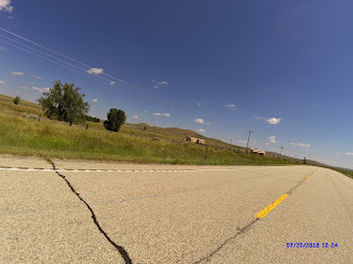
The landscape changed from mountains and plains to hills and plains.  Just took a few pictures today.

After a long hot day, when I walked into my hotel room I was greeted by hot air.  Must have been close to 90 in that room.  The maintenance guys worked on it without success and ended up replacing the entire unit.  I am finally cooled down as I write this post.

On Sunday we will visit Mount Rushmore, which I am looking forward to.

Today's pictures:
Our team heading out for the day - Jim, Courtney, Anni & Jim


The wide open plains.  Hard to see the hills with this shot.


Thursday, July 19, 2018

Day 12 - Powell to Sheridan, WY

Ride Stats:
Distance: 123.1 Miles
Climbing: 7,513ft
Ride Time:  8:32
Temp:  59-98 (68 at summit)

Today was a very long day, so I will keep this post short.  I can summarize the entire day with one word - Wow!!!

We climbed the Big Horn Mountains.  The scenery was spectacular.  The climb very difficult (grades up to 14%) to an elevation of 9,430 (still some snow banks up there)..  Then we were rewarded with a spectacular descent.  The descent was fast and technically difficult at times (3,600ft drop in 13 miles)..  I took a video of the entire descent but could not safely take pictures.  If I have time to extract a couple of pictures, I will update this post.  The video is too big to post.

Pictures from today:
Beginning the climb - Looked very intimidating

Getting close to the submit

Even higher


The Summit


Still have snow banks up here


Another from the climb

Last one from the climb